The Central government should put pressure on the WHO and compel them to replace the incorrect map of India. – Editor, HinduJagruti,org
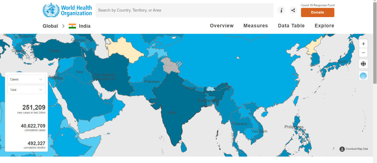
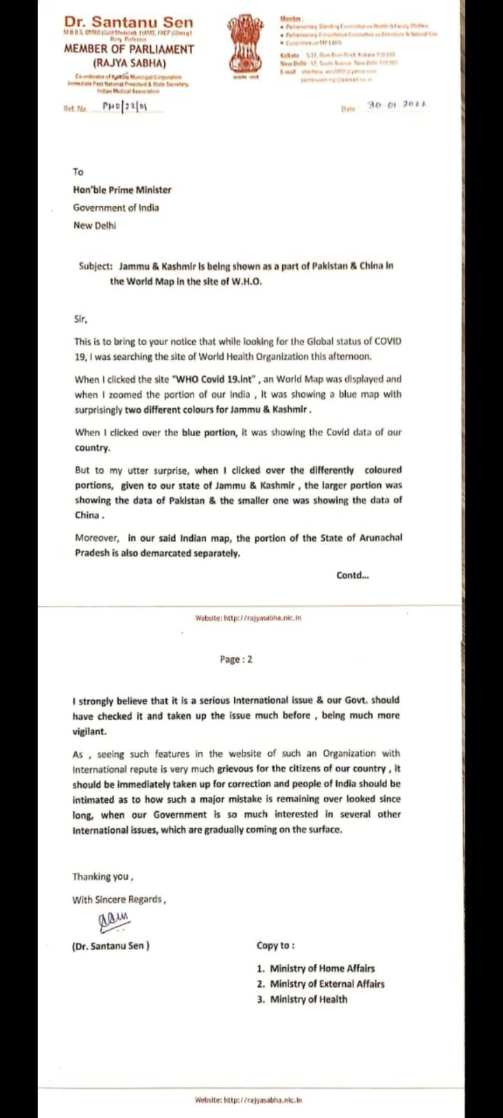
Trinamool Congress (TMC) MP Dr Santanu Sen has written to Prime Minister Narendra Modi, saying that the World Health Organization (WHO) is displaying an incorrect map of India, reported by India Today.

“When I clicked the site WHO Covid19.int, a world map was displayed, and when I zoomed into the portion of India, it showed a blue map with surprisingly two different colours for Jammu and Kashmir,” the MP wrote in his letter to PM Modi.

Sen said when he clicked over the blue portion, the map was showing him India’s data, but the other portion was showing Pakistan’s Covid-19 data.
.#WHO COVID https://t.co/HSTaKkj0Yc site shows map of #India with a separate colour for Jammu & Kashmir&inside that there is another small portion of a separate colour.
If they are clicked,#Covid datas of #Pakistan & #China are coming.@narendramodi must take up.@MamataOfficial pic.twitter.com/prSoZ2IsJg— DR SANTANU SEN (@SantanuSenMP) January 30, 2022
Calling it a serious international issue, the TMC MP said that the Indian government should have checked it and taken up the issue much earlier.
Santanu Sen also said that the people of India should be informed as to how such a major mistake is being overlooked.
In 2021, Twitter misrepresented India’s map, depicting Jammu and Kashmir as a separate country and large portions of Ladakh as China.
In October 2020, Twitter geo-tagged Leh as part of the People’s Republic of China, eliciting strong reactions from the Indian government, with Ajay Sawhney, Secretary of the Ministry of Electronics and Information Technology, writing a stern letter to Twitter’s founder and global chief, Jack Dorsey.
Any attempt by Twitter to disrespect the sovereignty and integrity of India is unlawful and totally unacceptable, the government had said in its letter.
After severe backlash, Twitter removed the incorrect map, which had previously appeared on the career section of the Twitter website under the header ‘Tweep Life.’
WHO showing distorted map of India since 2021; Had put a disclaimer after warning form Govt. of India
The government had said on February 4 2021, that the issue of wrong depiction of India’s map on World Health Organisation’s (WHO) website has been raised strongly, including at the highest level.
Speaking on the issue, Minister of State of the ministry of external affairs (MEA) V Muraleedharan said the WHO has now put a disclaimer on its portal.
“The issue of wrong depiction of map of India on World Health Organisation’s website has been raised strongly with WHO including at the highest level. In response WHO has informed Permanent Mission of India in Geneva that they’ve put a disclaimer on portal,” the minister said.
“The disclaimer says designations employed and presentation of these materials don’t imply expression of any opinion on part of WHO concerning legal status of any country, territory or area or of its authorities or concerning legal status of any country, territory or area of its authorities or concerning delimitation of its frontiers or boundaries. Dotted/dashed lines on maps represent approximate border lines for which there may not be full agreement,” Muraleedharan added.
Nevertheless, government of India’s position on right depiction of boundaries is unambiguously reiterated, he concluded.
India has conveyed its “deep displeasure” to WHO chief Tedros Adhanom Ghebreyesus over the issue. The government has sent three letter so far to the WHO chief, through its mission in Geneva.
In the last letter sent on January 8, India asked the world body to replace the incorrect maps.
The maps, including those in the coronavirus dashboard, show the union territories of Jammu and Kashmir and Ladakh in a different shade than the rest of India. The Shaksgam Valley spread across 5,168 sq km, which was illegally ceded by Pakistan to China in 1963, is shown as part of China. The Aksai Chin region occupied by China in 1954 is shown in light blue strips, a shade similar to the colour used to depict Chinese territory.


